Aircraft Radio Altimeters: Everything You Need to Know
Soaring through the skies, pilots navigate a complex environment, relying on an intricate network of onboard systems to ensure smooth and safe operation. Among these crucial tools lies the aircraft radio altimeter, an indispensable piece of equipment that plays a vital role in modern aviation. This article delves into the world of radio altimeters, exploring their function, working principle, features, applications, and significance in the aviation industry. It further examines the challenges and limitations encountered by these systems, traces their evolution over time, and discusses the future of radio altimeter technology.
What is a Radio Altimeter?
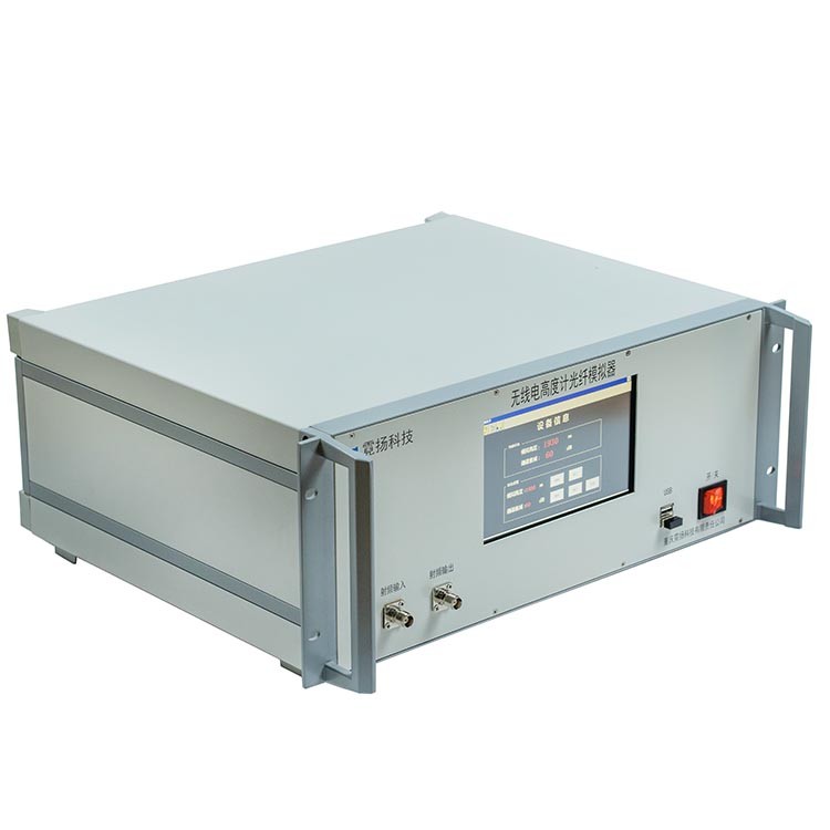
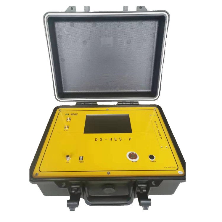
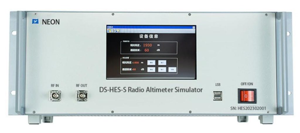
An aircraft radio altimeter is a crucial piece of avionics equipment that plays a vital role in enhancing flight safety, particularly during challenging operational scenarios. Its primary function is to provide accurate and independent measurements of an aircraft’s height above the terrain directly beneath it. This information is critical for safe and efficient navigation, especially during low-visibility approaches and landings as well as takeoffs and climbs to avoid controlled flight into terrain (CFIT) incidents.
Working Principle of Radio Altimeters
- Transmission: A radio altimeter generates a short burst of electromagnetic energy, specifically radio waves, directed downwards towards the ground.
- Reflection: When the radio waves encounter the ground, they bounce back (reflect) and travel back up towards the aircraft.
- Reception: The radio altimeter receives the reflected radio waves using an antenna.
- Time Measurement: The altimeter accurately measures the time it takes for the radio wave to travel from the aircraft to the ground and back.
- Distance Calculation: Knowing the speed of light (a constant value), the altimeter can calculate the distance between the aircraft and the ground by multiplying the measured time by the speed of light and dividing the result by two (since the signal travels the distance twice).
- Display: The calculated distance is then translated and displayed as the altitude above terrain (AGL) on the instrument panel, providing the pilot with information on the aircraft’s height above the immediate ground below.
Performance of Radio Altimeters
1. Range of Measurement
Radio altimeters are designed to operate within a specific range of altitudes, typically starting from low-altitude operations (near the ground) and extending to various maximum heights depending on the model. This range can vary from a few hundred feet to several thousand feet in more advanced models.
2. Accuracy and Integrity
Modern radio altimeters employ sophisticated technologies to ensure highly precise measurements and reliable data integrity. This is crucial for pilots to make safe and informed decisions during critical flight phases, particularly those requiring accurate altitude information.
Self-Test Capabilities:
Many radio altimeters incorporate built-in self-test functions. These tests enable the device to automatically verify its own operational status and identify any potential malfunctions before flight. This feature enhances overall system reliability and contributes to flight safety.
What are the Prices of Radio Altimeters?
The price of a radio altimeter varies significantly and depends on several factors, including:
Complexity: More sophisticated models with advanced features tend to be more expensive than simpler models.
- Functionality: Models with extended range, higher accuracy, or additional functionalities like self-test capabilities typically cost more.
- Target Market: Radio altimeters designed for larger commercial aircraft are generally more expensive than those used in smaller general aviation aircraft.
Overall, the cost of a radio altimeter can range from less than $10,000 for simpler models to over $100,000 for sophisticated models equipped with advanced features for large aircraft.
Radio Altimeter Applications in Aviation
Radio altimeters serve as the primary source of real-time height information for various critical applications in aviation:
1. Approach and Landing
- During Instrument Landing System (ILS) approaches, radio altimeters provide essential data for maintaining the correct glide path and achieving a safe touchdown, particularly in low-visibility conditions such as fog or heavy rain.
- They also play a crucial role in enabling low-visibility approaches and landings under challenging weather conditions, expanding operational capabilities, and improving airport accessibility.
2. Takeoff and Climb
Radio altimeters provide critical information for safe takeoff and climb maneuvers by:
- Supplying real-time data on clearance above the ground is especially important in situations with rising terrain or potential obstacles in the vicinity.
- This data is vital for preventing controlled flight into terrain (CFIT) incidents, where an aircraft collides with rising terrain due to pilot error or insufficient awareness of the surrounding environment.
3. Supporting Functionalities
- Radio altimeter data serves as an essential input for Ground Proximity Warning Systems (GPWS), which issue audible and visual alerts to pilots when the aircraft approaches dangerously close to the ground or obstacles.
- In some larger and more advanced aircraft, radio altimeters can also provide inputs for Automatic Landing Systems (Autoland), facilitating fully automated landings under specific conditions.
Importance of Radio Altimeters in Aviation
Radio altimeters play a critical and undeniable role in enhancing aviation safety, particularly during challenging operational scenarios. Their contributions encompass several key areas:
1. Enhanced Safety in Low-Visibility Conditions
Accurate and Independent Height Information: In situations with limited visual reference due to low visibility conditions such as fog, heavy rain, or even darkness, the ability to accurately determine aircraft height above the ground becomes critical for safe operation. Radio altimeters provide independent measurements, independent of atmospheric conditions or barometric pressure, offering pilots with reliable and precise information regarding their altitude above terrain (AGL). This information allows for safer approaches and landings by enabling pilots to maintain the correct glide path and avoid potential obstacles even when visual references are limited.
Reduced Risk of Accidents: By providing accurate AGL data during low-visibility situations, radio altimeters significantly reduce the risk of accidents that could occur due to misjudged height or incorrect approach calculations due to limited visual cues.
2. Enabling Low-Visibility Operations
Safe and Efficient Operations: In challenging weather conditions, radio altimeters play a vital role in facilitating safe and efficient operations. Their ability to provide reliable AGL information enables pilots to conduct safe approaches and landings even when visibility is limited, contributing to improved airport accessibility and enhanced schedule reliability. This allows for smoother operations in diverse weather conditions, minimizing disruptions and delays.
3. Preventing Controlled Flight into Terrain (CFIT) Incidents
Real-Time Terrain Clearance Data: During takeoff and climb phases, radio altimeters provide real-time data on the clearance between the aircraft and the surrounding terrain. This information is crucial for preventing CFIT incidents, which occur when an aircraft collides with rising terrain due to pilot error or insufficient awareness of the surrounding environment. By providing accurate and timely data, radio altimeters enable pilots to maintain safe clearance from the ground and avoid potential collisions, safeguarding lives and property.
Limitations and Challenges of Radio Altimeters
Despite their undeniable benefits, radio altimeters possess inherent limitations and face ongoing challenges that require continuous attention:
Limitations
Accuracy: The accuracy of a radio altimeter’s readings can be affected by various environmental factors. Certain materials on the ground surface, such as water, snow, and rough terrain, can influence the reflection of the radio signal, potentially leading to inaccuracies in the calculated altitude. For instance, water can absorb some of the radio waves, resulting in a slightly underestimated altitude reading.
External Influences: Radio altimeters are susceptible to interference from external radio sources. This can occur when other electronic devices operating on similar frequencies emit signals that overlap with the radio waves used by the altimeter. These unintended signals can potentially lead to inaccurate or misleading altitude readings. The development and deployment of new technologies like 5G cellular networks, which operate in frequencies close to those used by some radio altimeters, has raised concerns about potential interference and highlights the need for continued mitigation strategies.
Challenges
Maintaining Accuracy and Reliability: Ensuring the ongoing accuracy and reliability of radio altimeters in diverse operating environments is an ongoing challenge. This includes continual calibration and maintenance procedures to minimize the impact of environmental factors and ensure the altimeter continues to provide reliable data under various conditions. Additionally, advancements in technology are constantly pursued to improve the inherent accuracy of the system and minimize potential sources of error.
Mitigating Interference: Addressing the potential for interference from external radio sources like 5G cellular networks requires continual development of mitigation strategies. This can involve various approaches, such as:
- Refining radio altimeter design: Improving the filtering capabilities of the altimeter to better reject unwanted signals from other sources.
- Spectrum management: Implementing regulations and strategies to minimize the overlap between the frequencies used by radio altimeters and other electronic devices.
- Collaborative efforts: Ongoing collaboration between aviation authorities, radio altimeter manufacturers, and other stakeholders to develop and implement effective mitigation strategies for ensuring safe and reliable operation of radio altimeters in the future.
Evolution of Radio Altimeters: A Journey of Improvement
Radio altimeters have undergone significant advancements over time, with continuous improvements in technology and performance:
1. Early Development: Pulse Systems (Pre-1970s)
The earliest radio altimeters, developed before the 1970s, utilized pulse systems. These systems are operated by:
- Transmitting short bursts of radio waves at a specific frequency downwards towards the ground.
- Measuring the time it took for the radio waves to travel to the ground and reflect back to the aircraft.
- Calculating the distance between the aircraft and the ground based on the speed of light and the measured time.
While these early systems provided basic functionality, they had several limitations:
- Limited Accuracy: Pulse systems had relatively low accuracy, particularly at higher altitudes.
- Shorter Range: They also offered a shorter operational range compared to modern systems.
2. Advancement to FMCW Technology (1970s – Present)
Modern radio altimeters predominantly utilize Frequency Modulated Continuous Wave (FMCW) technology, which was introduced in the 1970s and offers significant improvements:
- Continuous Transmission: Instead of short bursts, FMCW technology transmits a continuous radio wave with a constantly changing frequency.
- Doppler Shift Measurement: The reflected signal experiences a Doppler shift due to the relative movement between the aircraft and the ground.
- Time Delay Calculation: By measuring the difference between the transmitted and received frequencies, the altimeter can determine the time delay of the reflected signal.
- Distance and Altitude Calculation: Knowing the speed of light and the calculated time delay, the altimeter can then accurately determine the distance between the aircraft and the ground, which is displayed as altitude above terrain (AGL).
FMCW technology offers several advantages over pulse systems:
- Increased Accuracy: It provides significantly higher accuracy compared to pulse systems, particularly at higher altitudes.
- Greater Range: FMCW technology allows for a wider operational range, making it suitable for various aviation applications.
Interference and Regulatory Measures
The potential for interference from external radio sources, like 5G cellular networks, presents a critical challenge for radio altimeters. To ensure the safety and reliability of aircraft navigation, various regulatory measures have been implemented:
1. Aircraft Design and Certification
- Stringent requirements are established for aircraft design and certification to minimize the susceptibility of radio altimeters to interference from external sources.
- These requirements include incorporating shielding and filtering techniques into the aircraft’s electrical systems to mitigate the impact of unwanted radio signals on the altimeter’s operation.
2. Spectrum Management and Allocation
- Regulatory bodies, like the Federal Communications Commission (FCC) in the United States, implement strategies for spectrum management and allocation.
- This involves designating dedicated radio frequency bands for aviation use, minimizing potential conflicts and interference with other technologies like 5G networks.
- Through coordination and collaboration between aviation authorities, regulatory bodies, and technology developers, efforts are ongoing to ensure the safe coexistence of different technologies and maintain the uninterrupted operation of radio altimeters.

Future of Radio Altimeters
The future of radio altimeters holds promise for continued advancements and integration with other onboard systems:
1. Continued Development
Ongoing research and development efforts aim to further enhance the capabilities of radio altimeters:
Improved Accuracy and Reliability: Advancements in technology will strive to achieve even greater accuracy and reliability under diverse operating conditions, including challenging weather scenarios.
Enhanced Resistance to Interference: The development of advanced filtering and signal processing techniques will focus on improving resistance to interference from external sources, ensuring uninterrupted operation in a complex electronic environment.
2. Integration with Other Systems
Future iterations of radio altimeters may witness potential integration with other onboard navigation and guidance systems, such as:
- Flight Management Systems (FMS)
- Autopilots
- Traffic Collision Avoidance Systems (TCAS)
This interconnectivity could provide pilots with a more comprehensive and unified data environment, enhancing situational awareness and decision-making capabilities.
By continuing to invest in research and development, addressing potential challenges like interference, and exploring opportunities for integration with other onboard systems, radio altimeters are poised to play a vital role in enhancing aviation safety and efficiency well into the future.
Conclusion
Aircraft radio altimeters serve as indispensable tools for enhancing aviation safety, particularly during challenging weather conditions and low-visibility operations. Their continued development and integration with other systems promise to further elevate flight safety in the years to come. While limitations and challenges exist, ongoing advancements in technology and robust regulatory measures ensure the continued vital role of radio altimeters as guardians of flight safety in the ever-evolving world of aviation.


